Trail Features

Accessibility
This trail is accessible for everyone.
Biking
This trail is accessible by bike.
Bridges
This trail has at least one bridge.
Bus
This trail is accessible by city transit.
Food & Drink
This trail has food & drink options.
Hiking
This trail is accessible by hiking.
Loop
Trail is a loop
Motorized
May Have Motorized Vehicles
Parking
Free parking at the trailhead.
Pet Friendly
This trail is pet friendly.
Restroom
This trail has a restroom for public use.
Water
This trail has water fountains.
Wifi
This trail has wifi access points.

Trail Difficulty

Easy
1 out of 5 Trail Condition good. Updated surfaces with light grade. Family Friendly.
Moderate
2 out of 5 Trail Condition good with light grade. May encounter rough trail surfaces and vehicles. Be prepared with proper trail essentials.
Challenging
3 out of 5 Trail Conditions can vary from good to needing improvement. May encounter fairly rough trail sections, Sand, Rock, Potholes, debris and may encounter vehicles. Can have long sections without any amenities. For the more adventurous user. Be prepared with proper trail essentials.
Difficult
4 out of 5 Trail Conditions can vary from good to poor. Will encounter rough sections along the way, steeper grades at parts and will most likely encounter vehicles. For adventurous users. Will have long sections without any amenities. Be prepared with proper trail essentials.
Very Difficult
5 out of 5 Trail conditions will vary and you will encounter poor conditons with rough sections, potholes, and steeper grades. You will encounter motor vehicles and long stretches of trail without amenities. This is a long section of trail requiring multiple days. Be prepared with proper trail essentials.

TRAIL MAP - select a trail section for details

Kettle Valley Rail Trail

492.58 Km
1. Several historic Mining towns on the route.
2. Wildlife viewing along rivers.
3. Vistas over Okanagan valley.
4. Bike packers - aggressive experience.
5. Week long trip experience.
Learn More

Christina Lake — Grand Forks ..

24.3 Km
1. Perfect family experience.
2. Bridge experience.
3. Grassland park and waterfall views.
4. Along the river.
5. Great wildlife to see on this experience.
Learn More

Grand Forks — Greenwood

38.9 Km
1. Adventurous terrain loose rocks.
2. Granby Tunnel (11 km east of Eholt Station).
3. Beautiful vistas (of Grandforks).
4. Amenities near the trail.
5. Day experiences.
Learn More

Greenwood — Midway

13.4 Km
1. Very family-friendly and pet-friendly (on leash)
2. Historic downtown Greenwood.
3. Historic Museums and sites at both ends of the trail.
4. Unique landscape.
5. Amenities along the trail - Unique cultural and historic experiences.
Learn More

Midway Town Trail

10 Km
1. Very family-friendly and pet-friendly (on leash).
2. Explore the history and culture and Mile Zero Rail Trails Museum.
3. Leisurely trail with stunning views along the 49th parallel.
4. Epic hiking nearby for adventurous souls.
5. Key bird watching location during spring and early summer.
Learn More

Midway — Rock Creek

18.8 Km
1. Kettle River Recreation area easily accessible from the trail.
2. Combine a cycling trip with a river float or swimming with easy access to Kettle River.
3. Replica caboose in Rhone (Cyclist's Rest).
4. Kettle River Museum.
5. Plentiful ecology - Wild life & agriculture
Learn More

Rock Creek — Westbridge

15 Km
1. Backcountry experience.
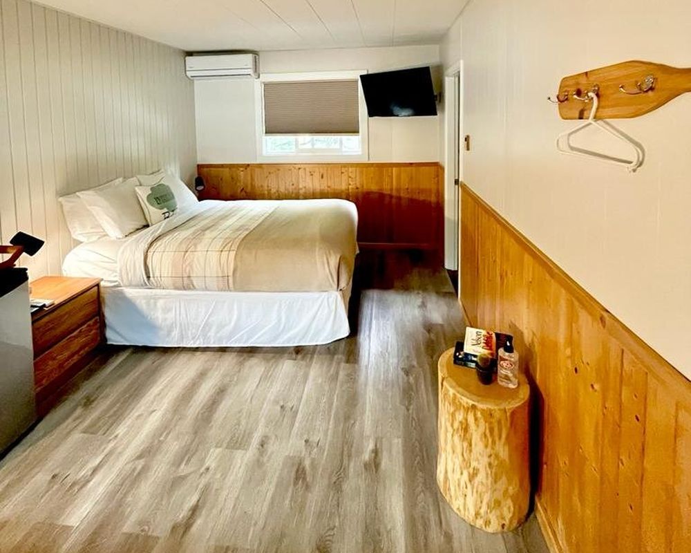
2. Mile 0 Motel - Go-to cyclists rest stop.
3. Family-Friendly.
4. Guided experiences available.
5. Wildlife trail.
Learn More

Westbridge — Arlington Lake

57.8 Km
1. Family-friendly
2. One of the longer trails
3. Slow incline
4. Wildlife Viewing
5. Camping and Accommodation at both ends of the trail
6. End at Arlington Lakes Recreational Park
Learn More

Arlington Lake — Myra Canyon

37.5 Km
1. Family-friendly, pet-friendly (on leash) - be aware it is a longer stretch
2. Steady upward slope
3. Amenities and camping at both ends of the trail
4. The trail is maintained making it accessible
5. Wildlife viewing
Learn More

Myra Canyon

24.9 Km
1. Ride over 16 man-made trestles, 2 steel bridges & through 2 tunnels.
2. Equipment rentals in the parking lot (Can book ahead of time).
3. 1265 ft above sea level, Connects through to South Okanagan (Penticton) section.
4. Family-friendly and pet-friendly (on leash)
5. Two entrances, Myra Station & Ruth Station.
Learn More

Myra Canyon — Chute Lake

36 Km
1. Family-friendly and pet-friendly (on leash)
2. Ride along 19 Trestles
3. 2 Tunnels
4. Ride Along steep walled canyons
5. Flat path, but watch for potholes
Learn More

Chute Lake — Naramata

23.6 Km
1. Explore the Adra Tunnel on foot.
2. Chute Lake Lodge Accommodation and Restaurant.
3. Extended expedition of the Naramata Bench.
4. Rock Ovens - Historical ovens still in place from railway days.
5. Family-friendly and pet-friendly (on leash)
Learn More

Naramata Bench

20.6 Km
1. 4-hour roundtrip w/ shuttle service.
2. Naramata Little Tunnel.
3. Connects with Trans Canada Rail Trail.
4. 20.6 km (12.8 mi).
5. Amenities along the way: wineries, cideries.
6. Rock Ovens Regional Park
Learn More

Naramata — Penticton

15.3 Km
1. Enjoy the surrounding wineries of Naramata Bench.
2. Amenities along the trail.
3. Family-friendly and pet-friendly (on leash).
4. Vista views of Lake Okanagan lake.
5. Bike rentals available for this experience.
Learn More

Penticton — Okanagan Falls

30.6 Km
1. Penticton former headquarters of KVR.
2. Very family-friendly and pet-friendly (on leash) - easy cycle.
3. Land on the Indigenous Syilx Nation.
4. Hugs Skaha Lake.
5. Accessible beaches to explore and swim.
Learn More

Okanagan Falls — Oliver

20.7 Km
1. Some of this route is on the highway
2. Amenities throughout the trail
3. Family-friendly - flat terrain, but be aware of the highway
4. Wineries in the Oliver section of the trail
5. Ride beside Skaha Lake
Learn More

Oliver — Osoyoos

22 Km
1. Family-friendly
2. Easily accessible - mostly paved
3. Option to stop at Osoyoos Oxbows – a great birding site.
4. Free parking at the Oliver Visitor centre at the beginning
5. Ride along Okanagan River Channel
Learn More

Princeton — Tulameen

26.2 Km
*Trail is closed due to Flood Damage*
1. Travel across the Trout Creek Bridge (73 metres above Trout Creek Canyon).
2. Views of Otter Lake, Osprey Lake, and Tulameen River.
3. Ride along bridges and through tunnels.
4. Great wildlife to be seen on this trail.
5. Family-friendly - Great family experience and adventure.
Learn More

Cold Stream — Kekuli Bay

20 Km
1. Views/access of/to Kalamalka Lake.
2. Day hike or cycle.
3. Swimming available along this route.
4. Camping area - easily accessible.
5. Very family-friendly and pet-friendly (on leash).
Learn More

Kekuli Bay — Lake Country

22.8 Km
1. Dual lake experience - Kalamalka Lake and Wood Lake
2. Family-friendly and pet-friendly (on leash).
3. Option for Day or overnight experience - Camping options.
4. Amenities along the trail.
5. An accessible experience for all explorers.
Learn More

Wood Lake Circle Route

17.5 Km
1. An accessible experience for all explorers.
2. Dual Lake experience, combining both Kalamalka Lake and Wood Lake.
3. Easy hike, cycle or simply take a break and have a swim.
4. Very family-friendly and pet-friendly (on leash).
5. Amenities along the trail.
Learn More

Lake Country — YLW (Currently..

12.6 Km
This Trail is currently CLOSED due to construction
Learn More

YLW — Downtown Kelowna

14.6 Km
1. Family friendly and Pet friendly (on leash)
2. Flat trail making it appropriate for beginners and accessible to all.
3. Ending at Okanagan Lake Waterfront Park.
4. Amenities along the way: Wineries, cideries restaurants, cafes.
5. Enjoy riding along the mountains through Kelowna.
Learn More

Nakusp & Slocan Rail Trail

46 Km
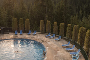
1. Visit the lovely Nakusp Hot Springs just north of the village.
2. This trail is ideal for hiking, biking, trail running, Nordic skiing.
3. The quaint village of Hills is home to the popular Hills Garlic Festival every September.
4. Rosebery Provincial Park offers camping adjacent to Wilson Creek.
5. Connect to the Galena Trail featuring a cable car ride over Carpenter Creek.
Learn More

Slocan - Slocan Valley Rail Trail

50 Km
1. Hike, bike, horseback ride, Nordic ski or snowshoe.
2. Interpretive signage along the way depicting history of the area.
3. Excellent birdwatching at The Walter Clough Wildlife Sanctuary.
4. Slocan River and lake offers fishing opportunities.
5. Perfect for families, the trail can be done in sections with 7 trailheads.
Learn More

New Denver/Sandon - Galena Trail

13 Km
1. The trail is ideal for hiking, biking, trail riding, Nordic skiing.
2. The quaint town of New Denver is set alongside Slocan Lake.
3. Spectacular mountain views.
4. Pass by the many relics of the mining boom.
5. The heritage ghost town of Sandon is just south from Three Forks.
Learn More

Kaslo - K&S Rail Trail

30 Km
1. Bicycles, horses, ATVs, vehicles and hikers share portions of this trail.
2. The village of Kaslo is filled with shops, galleries and attractions.
3. Much of the trail follows the 1892 wagon trail.
4. Sections of the trail follow the historic K&S Railway.
5. Fishing at the Fish Lake Rest Stop.
Learn More

Nelson - Great Northern Rail Trail

48 Km
1. Hike, bike, horseback riding, Nordic ski, snowshoe.
2. The village of Salmo showcases 6 unique flagstone murals.
3. White sandy Troup Beach at Five Mile Point.
4. You will cross three wooden bridges.
5. Stunning views and wildlife viewing opportunities.
Learn More

Cranbrook - Chief Isadore Trail

43.5 Km
1. Hike, bike, horseback ride, Nordic ski or snowshoe.
2. Cranbrook's Community Forest is located just off this trail.
3. Wardner Provincial Park is a lovely day-use area on a riverbank.
4. Rampart Rest Area Loop.
5. Breathtaking views of the Rocky Mountains.
Learn More

Kimberley - North Star Rail Trail

26 Km
1. Hike, bike, stroller, inline skates, skateboard, Nordic ski or snowshoe.
2. Interpretive signage along the way depicting history of the area.
3. Outstanding Rocky Mountain views.
4. Massive bridge over the St. Mary River includes viewpoints.
5. Picnic tables and benches along the way.
Learn More

Invermere - Westside Legacy Trail

25 Km
1. Three road crossings and 3 creek crossings.
2. Two trailhead kiosks and interpretive areas.
3. Benches and picnic tables dot the trail.
4. Enjoy a snack at one of the 5 scenic picnic areas.
5. Visit the therapeutic Fairmont Hot Springs mineral pools.
Learn More

E&N Rail Trail - Humpback Conne..

13.5 Km
This trail that runs along railway, snakes its way through urban, industrial, and along waterways from Victoria west toward Western communities ending in Langford.
Learn More

The Lochside Trail

29 Km
This picturesque multi–use trail, formerly a railway line, stretches from Swartz Bay to Victoria, traveling past beaches, farmland, and wetlands, down country lanes and beside suburban backyards.
Learn More

Galloping Goose Regional Trail

55 Km
This picturesque multi-use trail, formerly a railway line, moves through urban, rural and wilderness scenery on its 55-kilometre journey from Victoria to Sooke.
Learn More

Cowichan Valley Rail Trail

122 Km
The Cowichan Valley Trail is a spectacular 120km multi-use trail that is an integral part of the Trans Canada Trail route on Southern Vancouver Island.
Learn More

Coombs to Parksville Rail Trail

10 Km
Learn More

Rail Trail Community

Explore All

Tag us on instagram #railtrailbc